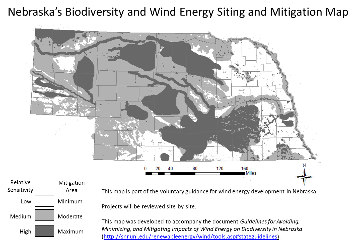
This map was developed through extensive collaboration of natural resource managers, non-profit conservation organizations, public utilities, and a variety of other wind energy stakeholders.
The purpose of the map is to delineate areas where potential adverse impacts of wind energy on biodiversity, including wildlife concentrations, in Nebraska are most likely to occur and the subsequent level of mitigation that will likely be recommended.
The Map is based on a variety of other maps and GIS layers, some of which were developed specifically for these guidelines. An explanation of how maps and layers contributing to the Map were developed is provided in Appendix A of the Guidelines for Avoiding, Minimizing, and Mitigating Impacts of Wind Energy on Biodiversity in Nebraska.
Wind energy developers and planners are encouraged to refer to this Map as an initial step when considering new sites.
This map is one of the decision support tools that is available for wind energy developers in the state of Nebraska.
Learn More
Click on a map to learn how it was developed and contributed to Nebraska's Biodiversity and Wind Energy Siting and Mitigation Map.


