Natural Communities in Nebraska
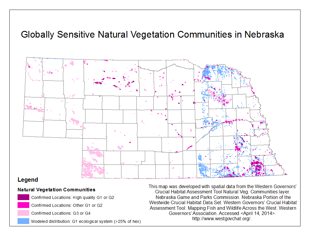
A global rank was assigned to natural communities by NatureServe, a non-profit conservation organization with a network of natural heritage programs (http://www.natureserve.org/), according to their relative rarity and endangerment on a scale of 1 to 5. In general, more endangered communities are considered higher priority for conservation efforts.
Nebraska uses a state ranking system similar to NatureServe to designate the conservation status or relative endangerment within the state of species or ecological communities. Primary factors used in determining rank for species are population size, number of occurrences, viability of occurrences, population trend, and threats. Secondary factors are geographic distribution, environmental specificity, protection and management, and intrinsic vulnerability.
Global Ranks: State Ranks:
G1 = Critically imperiled at range-wide level S1 = Critically imperiled in Nebraska
G2 = Imperiled at a range-wide level S2 = Imperiled in Nebraska
G3 = Vulnerable at a range-wide level S3 = Rare and uncommon in Nebraska
G4 = Apparently secure at a range-wide level S4 = Apparently secure in Nebraska
G5 = Secure at a range-wide level S5 = Secure and widespread in Nebraska
Individual community types are often difficult for persons unfamiliar with the Nebraska classification system to distinguish from other similar community types. Therefore, the Nebraska Natural Communities have been lumped into 12 general types and assigned to a category.
Medium Sensitivity/Moderate Mitigation:
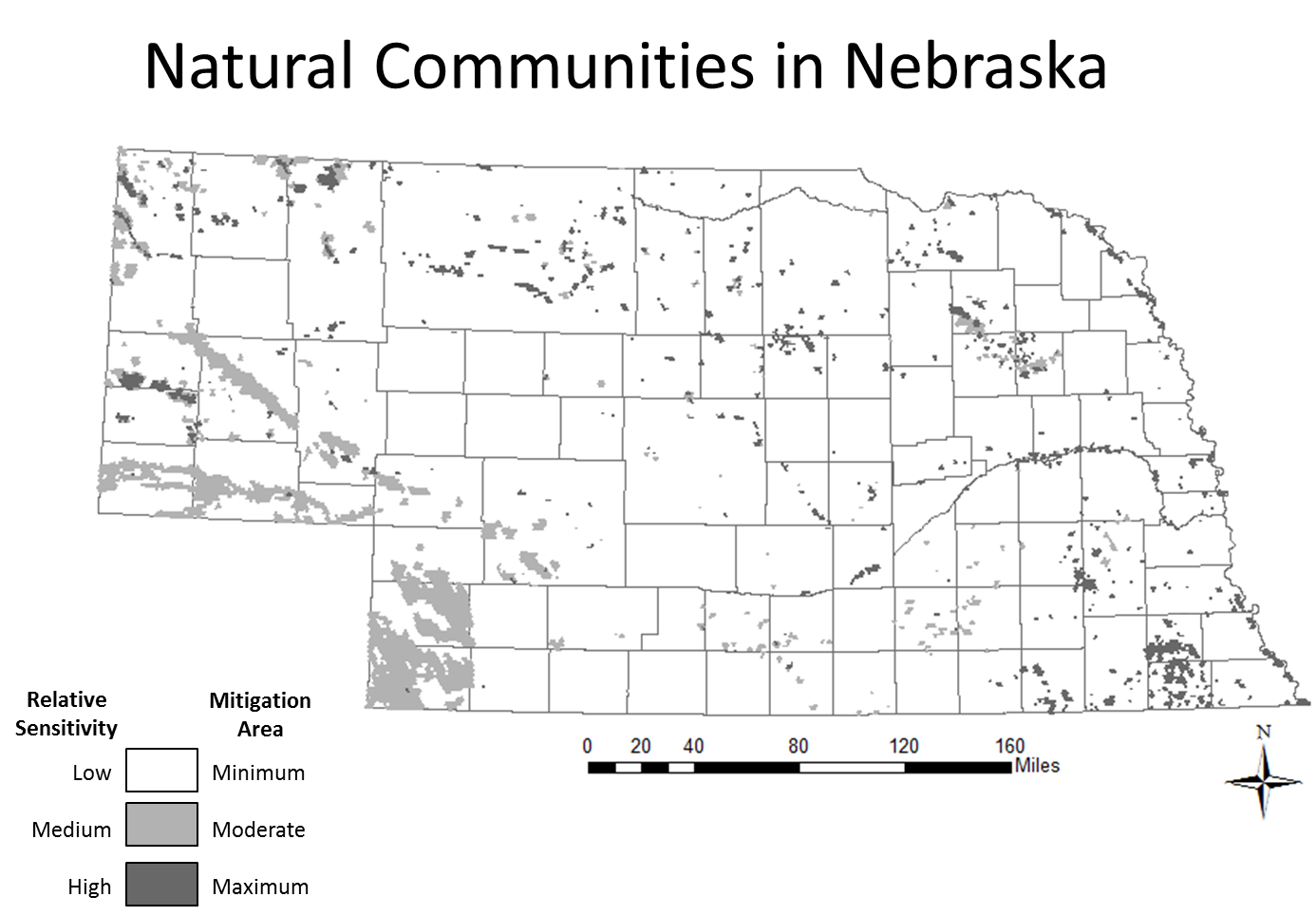
- Cedar Woodland
- Shrubland
- Mixed-grass Prairie
- Sand Prairie
- Sandbar
- Sparsely Vegetated Community
- Wetland
High Sensitivity/Maximum Mitigation:
- Riparian Forest and Woodland
- Eastern Deciduous Forest and Woodland
- Pine Forest and Woodland
- Tallgrass Prairie
- Wet Meadow and Fen
How this map was used: All natural communities ranked by NatureServe as G3 to G5 and communities ranked by the Nebraska Natural Heritage Program as S3 to S5 were classified as Medium Relative Sensitivity and Moderate Mitigation Areas. All natural communities ranked by NatureServe as G1 to G2 and communities ranked by the Nebraska Natural Heritage Program as S1 to S2 were classified as High Relative Sensitivity and Maximum Mitigation Areas.